
Athalassas National Park topographic map
Interactive map
Click on the map to display elevation.
About this map
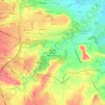
Name: Athalassas National Park topographic map, elevation, terrain.
Average elevation: 163 m
Minimum elevation: 119 m
Maximum elevation: 200 m
Other topographic maps
Click on a map to view its topography, its elevation and its terrain.
Athalassa Lake
Athalassa Lake, Aglangia, Nicosia, Nicosia District, Cyprus
Average elevation: 166 m