
Athalassa Lake topographic map
Interactive map
Click on the map to display elevation.
About this map
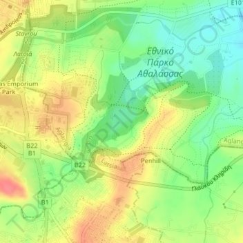
Name: Athalassa Lake topographic map, elevation, terrain.
Location: Athalassa Lake, Aglangia, Nicosia, Nicosia District, Cyprus (35.12615 33.38444 35.12921 33.39012)
Average elevation: 166 m
Minimum elevation: 135 m
Maximum elevation: 199 m
Other topographic maps
Click on a map to view its topography, its elevation and its terrain.