Geolocate

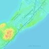
Burke topographic map

Click on the map to display elevation.

About this map

Name: Burke topographic map, elevation, terrain.

Location: Burke, Madison, Dane County, Wisconsin, 53783, United States (43.11583 -89.29623 43.15583 -89.25623)

Average elevation: 292 m

Minimum elevation: 260 m

Maximum elevation: 329 m

Other topographic maps

Click on a map to view its topography, its elevation and its terrain.

Summit Woods

United States > Wisconsin > Dane County > Madison

Average elevation: 302 m

Majestic Oaks

United States > Wisconsin > Dane County > Madison

Average elevation: 269 m

Nobel Park

United States > Wisconsin > Dane County > Madison

Average elevation: 273 m

Summit Woods

United States > Wisconsin > Dane County > Madison

Average elevation: 302 m

Gear up for your next adventure:

🔦Keychain LED Torches - Emergency backup light for finding gear in your pack
🧥Packable Down Jackets - Lightweight warmth that compresses small in your bag
🕶️Polarized Sunglasses - Reduces glare from snow and water when reading terrain
⛺Lightweight Solo Tents - Backpacking tents designed for wild camping in the UK highlands
🚲Cycling GPS Computers - Track elevation and topographic routes on two wheels

As an Amazon Associate, this site earns from qualifying purchases at no extra cost to you.