
Levron topographic map
Interactive map
Click on the map to display elevation.
About this map
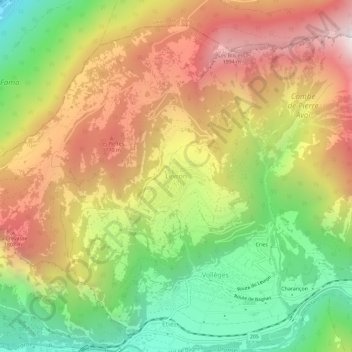
Name: Levron topographic map, elevation, terrain.
Location: Levron, Val de Bagnes, Entremont, Wallis, 1934, Schweiz (46.07923 7.14330 46.11923 7.18330)
Average elevation: 1,296 m
Minimum elevation: 498 m
Maximum elevation: 2,128 m
Other topographic maps
Click on a map to view its topography, its elevation and its terrain.
Le Catogne
Schweiz > Wallis > Entremont > Sembrancher
Le Catogne, Sembrancher, Entremont, Wallis, 2303, Schweiz
Average elevation: 1,949 m
Bourg-Saint-Pierre
Bourg-Saint-Pierre, Entremont, Wallis, 1946, Schweiz
Average elevation: 2,530 m
Champex-Lac
Champex-Lac, Orsières, Entremont, Wallis, 2303, Schweiz
Average elevation: 1,552 m