Geolocate

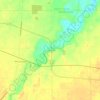
Wakeman topographic map

Click on the map to display elevation.

About this map

Name: Wakeman topographic map, elevation, terrain.

Location: Wakeman, Wakeman Township, Huron County, Ohio, 44889, United States (41.24751 -82.41239 41.26058 -82.38971)

Average elevation: 263 m

Minimum elevation: 241 m

Maximum elevation: 273 m

Other topographic maps

Click on a map to view its topography, its elevation and its terrain.
Celeryville

United States > Ohio > Huron County

Average elevation: 286 m

Clarksfield

United States > Ohio > Huron County

Average elevation: 275 m

Havana

United States > Ohio > Huron County

Average elevation: 253 m

East Norwalk

United States > Ohio > Huron County

Average elevation: 225 m

Peru

United States > Ohio > Huron County

Average elevation: 247 m

Gear up for your next adventure:

📚UK Hiking Guidebooks - Detailed route descriptions for the Lake District, Peaks, and Highlands
🔦Waterproof LED Headlamps - Hands-free lighting for evening treks and emergency navigation
📐Altimeters & Barometers - Tools for measuring altitude and air pressure
🌄Outdoor Binoculars - Compact binoculars for landscape observation
🧘Folding Sit Mats - Dry and warm seat for map-reading breaks on damp ground

As an Amazon Associate, this site earns from qualifying purchases at no extra cost to you.