
Arriate topographic map
Interactive map
Click on the map to display elevation.
About this map
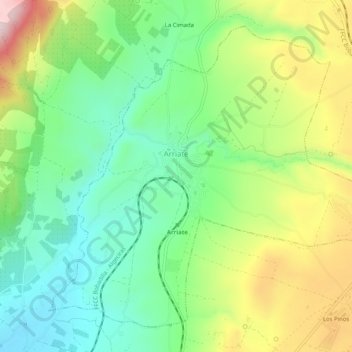
Name: Arriate topographic map, elevation, terrain.
Location: Arriate, Serranía de Ronda, Malaga, Andalousie, 29350, Espagne (36.77911 -5.15915 36.81393 -5.10838)
Average elevation: 658 m
Minimum elevation: 514 m
Maximum elevation: 902 m
Other topographic maps
Click on a map to view its topography, its elevation and its terrain.
Ronda
Espagne > Andalousie > Serranía de Ronda > Ronda > Ronda
Ronda, Serranía de Ronda, Malaga, Andalousie, 29400, Espagne
Average elevation: 679 m