
柏原市 topographic map
Interactive map
Click on the map to display elevation.
About this map
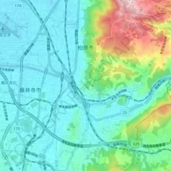
Name: 柏原市 topographic map, elevation, terrain.
Location: 柏原市, 大阪府, 日本 (34.54699 135.60751 34.60681 135.68199)
Average elevation: 89 m
Minimum elevation: 6 m
Maximum elevation: 389 m
Other topographic maps
Click on a map to view its topography, its elevation and its terrain.