
Make a donation
Gear up for your next adventure:
As an Amazon Associate, this site earns from qualifying purchases at no extra cost to you.
Pulau Gureda topographic map
Click on the map to display elevation.
Make a donation
Gear up for your next adventure:
As an Amazon Associate, this site earns from qualifying purchases at no extra cost to you.
About this map
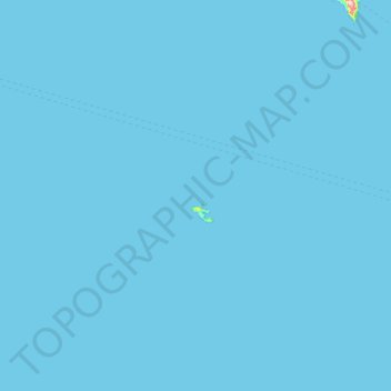
Name: Pulau Gureda topographic map, elevation, terrain.
Location: Pulau Gureda, North Maluku, Maluku, Indonesia (0.68000 125.81333 1.32000 126.45333)
Average elevation: 0 m
Minimum elevation: 0 m
Maximum elevation: 346 m
Make a donation
Gear up for your next adventure:
As an Amazon Associate, this site earns from qualifying purchases at no extra cost to you.
Other topographic maps
Click on a map to view its topography, its elevation and its terrain.
Make a donation
Gear up for your next adventure:
As an Amazon Associate, this site earns from qualifying purchases at no extra cost to you.
Make a donation
Gear up for your next adventure:
As an Amazon Associate, this site earns from qualifying purchases at no extra cost to you.
Tidore Islands
Tidore Island consists of a large stratovolcano which rises from the seafloor to an elevation of 1,730 m (5,676 ft) above sea level at the conical Kie Matubu on the south end of the island. The northern side of the island contains a caldera, Sabale, with two smaller volcanic cones within it.
Average elevation: 84 m
Make a donation
Gear up for your next adventure:
As an Amazon Associate, this site earns from qualifying purchases at no extra cost to you.
Make a donation
Gear up for your next adventure:
As an Amazon Associate, this site earns from qualifying purchases at no extra cost to you.
Aketajawe Lolobata National Park
Indonesia > North Maluku > Halmahera Timur
Threats to the national park are posed by illegal logging and mining. Between 1990 and 2003 forests declined in North Maluku from 86% to just under 70%, with much of it occurring in the lowlands (below 400m). As a result, species with large amounts of their range at low elevations were most strongly affected.
Average elevation: 161 m
Make a donation
Gear up for your next adventure:
As an Amazon Associate, this site earns from qualifying purchases at no extra cost to you.
Make a donation
Gear up for your next adventure:
As an Amazon Associate, this site earns from qualifying purchases at no extra cost to you.