Geolocate

Stillwater topographic map

Click on the map to display elevation.

About this map
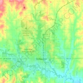
Name: Stillwater topographic map, elevation, terrain.

Location: Stillwater, Payne County, Oklahoma, United States (36.07906 -97.14957 36.20450 -97.01539)

Average elevation: 286 m

Minimum elevation: 257 m

Maximum elevation: 341 m

Other topographic maps

Click on a map to view its topography, its elevation and its terrain.

Enclave

United States > Oklahoma > Payne County > Stillwater

Average elevation: 271 m

Stillwater

United States > Oklahoma > Payne County > Stillwater

Average elevation: 295 m

Gear up for your next adventure:

🔋Rechargeable Batteries - Eco-friendly power for headlamps and older GPS units
🔦LED Camping Lanterns - Illumination for reading maps inside your tent at night
🐕Dog Hiking Gear - Equipment for hiking safely with dogs
🥾Women's Waterproof Hiking Boots - High-performance trekking boots designed for all-weather comfort
🛌Insulated Sleeping Mats - Crucial thermal protection when sleeping on cold, uneven ground

As an Amazon Associate, this site earns from qualifying purchases at no extra cost to you.