Geolocate

Enclave topographic map

Click on the map to display elevation.

About this map
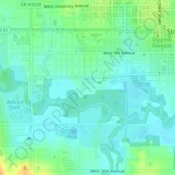
Name: Enclave topographic map, elevation, terrain.

Location: Enclave, Stillwater, Payne County, Oklahoma, United States (36.10548 -97.07935 36.10841 -97.07383)

Average elevation: 271 m

Minimum elevation: 262 m

Maximum elevation: 293 m

Other topographic maps

Click on a map to view its topography, its elevation and its terrain.

Stillwater

United States > Oklahoma > Payne County > Stillwater

Average elevation: 295 m

Gear up for your next adventure:

🥤Hiking Water Bottles - Reusable bottles for hydration on the trail
🥾Women's Waterproof Hiking Boots - High-performance trekking boots designed for all-weather comfort
🖼️Topographic Map Art - Decorative 3D-effect posters of famous UK peaks and regions
🧺Mesh Stuff Sacks - Breathable storage for wet gear or camp organization
🎒Replacement Sternum Straps - Repair parts for hiking rucksacks

As an Amazon Associate, this site earns from qualifying purchases at no extra cost to you.