
Fene topographic map
Interactive map
Click on the map to display elevation.
About this map
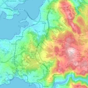
Name: Fene topographic map, elevation, terrain.
Location: Fene, Ferrol, A Corogne, Galice, Espagne (43.42314 -8.20484 43.48769 -8.09923)
Average elevation: 130 m
Minimum elevation: -2 m
Maximum elevation: 385 m
Other topographic maps
Click on a map to view its topography, its elevation and its terrain.