
Santa María Begoña topographic map
Interactive map
Click on the map to display elevation.
About this map
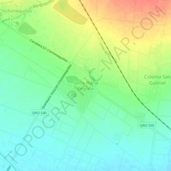
Name: Santa María Begoña topographic map, elevation, terrain.
Location: Santa María Begoña, El Marqués, Querétaro, México (20.72750 -100.33750 20.76750 -100.29750)
Average elevation: 1,959 m
Minimum elevation: 1,939 m
Maximum elevation: 1,990 m
Other topographic maps
Click on a map to view its topography, its elevation and its terrain.
San José Navajas
México > Querétaro > El Marqués > San José Navajas
San José Navajas, El Marqués, Querétaro, 76278, México
Average elevation: 1,926 m
San Vicente Ferrer
México > Querétaro > El Marqués > San Vicente Ferrer
San Vicente Ferrer, El Marqués, Querétaro, México
Average elevation: 1,965 m