
Make a donation
Gear up for your next adventure:
As an Amazon Associate, this site earns from qualifying purchases at no extra cost to you.
Keban Dam topographic map
Click on the map to display elevation.
Make a donation
Gear up for your next adventure:
As an Amazon Associate, this site earns from qualifying purchases at no extra cost to you.
Keban Dam
The Keban Dam is a combined rockfill and concrete gravity hydroelectric dam operated by the State Hydraulic Works (DSİ). The dam is 1,097 metres (3,599 ft) long and its crest is 207 metres (679 ft) above the level of the river-bed (848 metres (2,782 ft) above sea-level). Its eight water turbines are capable of producing 1,330 MW. The storage capacity of Lake Keban is 30.6 cubic kilometres (7.3 cu mi) and the surface area of the lake is 675 square kilometres (261 sq mi), although the lake has reportedly reached higher levels in the past. Due to Lake Keban's relatively high elevation at 845 metres (2,772 ft) above sea-level and its location in an area with high precipitation, evaporation is relatively low at 0.48 cubic kilometres (0.12 cu mi) per year compared to reservoirs in Syria or Iraq. Apart from the Euphrates Valley directly upstream of the dam, the lake has also flooded parts of valleys of the Murat River and the Karasu, the two rivers from which the Euphrates emerges. Although the dam was not originally intended for irrigation, 63,872 hectares (157,830 acres) of agricultural land was irrigated from Lake Keban in 1999.
Make a donation
Gear up for your next adventure:
As an Amazon Associate, this site earns from qualifying purchases at no extra cost to you.
About this map
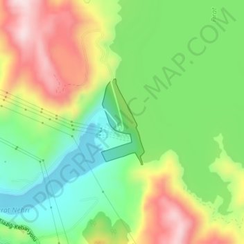
Name: Keban Dam topographic map, elevation, terrain.
Location: Keban Dam, Keban, Elazığ, Eastern Anatolia Region, Turkey (38.80330 38.75369 38.81276 38.75972)
Average elevation: 844 m
Minimum elevation: 684 m
Maximum elevation: 1,061 m
Make a donation
Gear up for your next adventure:
As an Amazon Associate, this site earns from qualifying purchases at no extra cost to you.
Other topographic maps
Click on a map to view its topography, its elevation and its terrain.