Geolocate

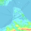
Manoc-Manoc topographic map

Click on the map to display elevation.

About this map

Name: Manoc-Manoc topographic map, elevation, terrain.

Location: Manoc-Manoc, Malay, Aklan, Western Visayas, 5608, Philippines (11.93853 121.92643 11.96116 121.95190)

Average elevation: 5 m

Minimum elevation: 0 m

Maximum elevation: 39 m

Other topographic maps

Click on a map to view its topography, its elevation and its terrain.

Poblacion

Philippines > Aklan > Malay

Average elevation: 42 m

Potol

Philippines > Aklan > Malay > Argao > Potol

Average elevation: 28 m

Nabaoy

Philippines > Aklan > Malay

Average elevation: 93 m

Tabon

Philippines > Aklan > Malay > Union

Average elevation: 6 m

Nabaoy

Philippines > Aklan > Malay

Average elevation: 88 m

Naasug

Philippines > Aklan > Malay

Average elevation: 56 m

Banga

Philippines > Aklan > Malay > Argao

Average elevation: 27 m

Punta Bunga Beach

Philippines > Aklan > Malay

Average elevation: 16 m

Ilig Iligan Beach

Philippines > Aklan > Malay

Average elevation: 13 m

Mount Luho

Philippines > Aklan > Malay

Average elevation: 14 m

Caticlan

Philippines > Aklan > Malay

Average elevation: 8 m

Caticlan

Philippines > Aklan > Malay

Average elevation: 8 m

Mount Luho

Philippines > Aklan > Malay

Average elevation: 14 m

Chalung

Philippines > Aklan > Malay > Cubay Sur

Average elevation: 25 m

Gear up for your next adventure:

🧼Camping Hygiene Kits - Compact hygiene essentials for outdoor stays
🍲Portable Camping Stoves - Fast-boiling stoves for hot meals on remote topographic survey trips
🪢Paracord - Multi-purpose cord for camping and survival
🥾Walking Shoes - Lightweight walking shoes for countryside and coastal paths
📚UK Hiking Guidebooks - Detailed route descriptions for the Lake District, Peaks, and Highlands

As an Amazon Associate, this site earns from qualifying purchases at no extra cost to you.