
Ares topographic map
Interactive map
Click on the map to display elevation.
About this map
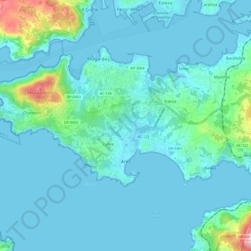
Name: Ares topographic map, elevation, terrain.
Location: Ares, Ferrol, Corunha, Galiza, Espanha (43.41756 -8.31656 43.45979 -8.19692)
Average elevation: 35 m
Minimum elevation: -1 m
Maximum elevation: 294 m
Other topographic maps
Click on a map to view its topography, its elevation and its terrain.