
KG Landstraße topographic map
Interactive map
Click on the map to display elevation.
About this map
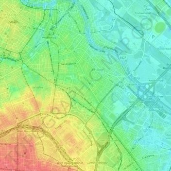
Name: KG Landstraße topographic map, elevation, terrain.
Location: KG Landstraße, Landstraße, Viena, 1030, Austria (48.17538 16.37505 48.21318 16.43017)
Average elevation: 180 m
Minimum elevation: 153 m
Maximum elevation: 221 m
Other topographic maps
Click on a map to view its topography, its elevation and its terrain.