
Pantón topographic map
Interactive map
Click on the map to display elevation.
About this map
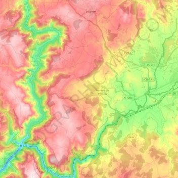
Name: Pantón topographic map, elevation, terrain.
Location: Pantón, Terra de Lemos, Lugo, Galicien, Spanien (42.42170 -7.73110 42.59594 -7.55359)
Average elevation: 444 m
Minimum elevation: 108 m
Maximum elevation: 728 m
Other topographic maps
Click on a map to view its topography, its elevation and its terrain.
Ferreira de Pantón
Spanien > Galicien > Terra de Lemos > Pantón
Ferreira de Pantón, Pantón, Terra de Lemos, Lugo, Galicien, 27430, Spanien
Average elevation: 405 m