
和光市 topographic map
Interactive map
Click on the map to display elevation.
About this map
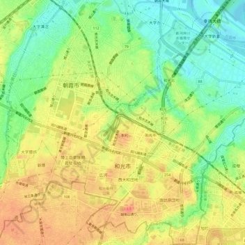
Name: 和光市 topographic map, elevation, terrain.
Location: 和光市, 埼玉県, 日本 (35.76661 139.59691 35.81321 139.64631)
Average elevation: 29 m
Minimum elevation: -1 m
Maximum elevation: 56 m
Other topographic maps
Click on a map to view its topography, its elevation and its terrain.