
Make a donation
Gear up for your next adventure:
As an Amazon Associate, this site earns from qualifying purchases at no extra cost to you.
Al Hajar Mountains topographic map
Click on the map to display elevation.
Make a donation
Gear up for your next adventure:
As an Amazon Associate, this site earns from qualifying purchases at no extra cost to you.
Al Hajar Mountains
The high topography is around two major culminations: Jabal Akhdar and Saih Hatat, which are large scale anticlines. The Saih Hatat culmination contains eclogite in the northeast at As Sifah. These rocks were subducted to about 80 km (50 mi) depth into the mantle, and then exhumed back to the surface. This exhumation event created possibly the largest megasheath fold on Earth, the Wadi Mayh megasheath fold. The common view is that these eclogites were originally basic volcanic rocks within the leading edge of the continental crust of the Arabian Plate. This leading edge was then subducted by a NE-dipping subduction zone. However, some geologists have interpreted that these eclogites were subducted through a SW-dipping subduction zone.
Make a donation
Gear up for your next adventure:
As an Amazon Associate, this site earns from qualifying purchases at no extra cost to you.
About this map
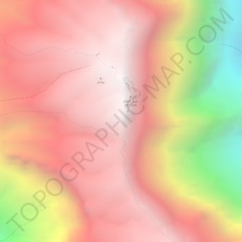
Name: Al Hajar Mountains topographic map, elevation, terrain.
Location: Al Hajar Mountains, Al Batinah South Governorate, Oman (23.23495 57.26245 23.23505 57.26255)
Average elevation: 2,502 m
Minimum elevation: 1,454 m
Maximum elevation: 2,985 m
Make a donation
Gear up for your next adventure:
As an Amazon Associate, this site earns from qualifying purchases at no extra cost to you.
Other topographic maps
Click on a map to view its topography, its elevation and its terrain.