
Dopshar-ri Gewog topographic map
Interactive map
Click on the map to display elevation.
About this map
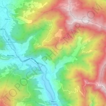
Name: Dopshar-ri Gewog topographic map, elevation, terrain.
Location: Dopshar-ri Gewog, Paro District, 12001, Bhutan (27.36339 89.40264 27.42031 89.50201)
Average elevation: 2,829 m
Minimum elevation: 2,176 m
Maximum elevation: 3,739 m
Other topographic maps
Click on a map to view its topography, its elevation and its terrain.