Geolocate

Kepez topographic map

Click on the map to display elevation.

About this map

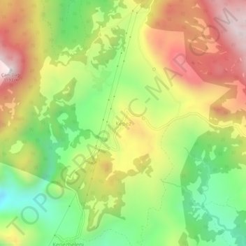
Name: Kepez topographic map, elevation, terrain.

Location: Kepez, Akseki, Antalya, Mediterranean Region, Turkey (36.90271 31.59661 36.94271 31.63661)

Average elevation: 753 m

Minimum elevation: 343 m

Maximum elevation: 1,209 m

Gear up for your next adventure:

🧗Locking Carabiners - Secure gear to your pack or for light technical use
Lightweight Tents - Compact tents for backpacking and trekking
📚UK Hiking Guidebooks - Detailed route descriptions for the Lake District, Peaks, and Highlands
🔦Outdoor Torches - Reliable torches for night navigation
🗺️Ordnance Survey Maps - Official UK maps for walking and outdoor activities

As an Amazon Associate, this site earns from qualifying purchases at no extra cost to you.