
Khash Rod topographic map
Interactive map
Click on the map to display elevation.
About this map
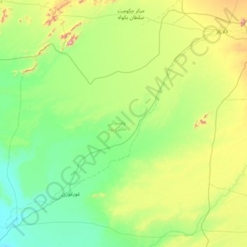
Name: Khash Rod topographic map, elevation, terrain.
Location: Khash Rod, Nimruz Province, Afghanistan (31.25093 62.30434 32.25679 63.58947)
Average elevation: 693 m
Minimum elevation: 491 m
Maximum elevation: 1,545 m
Other topographic maps
Click on a map to view its topography, its elevation and its terrain.