
渭宁 topographic map
Interactive map
Click on the map to display elevation.
About this map
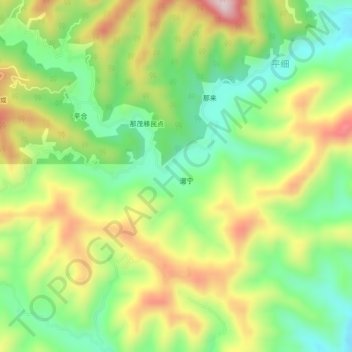
Name: 渭宁 topographic map, elevation, terrain.
Location: 渭宁, 田林县, 百色市, 广西壮族自治区, 中国 (24.13190 106.09300 24.17190 106.13300)
Average elevation: 536 m
Minimum elevation: 376 m
Maximum elevation: 757 m
Other topographic maps
Click on a map to view its topography, its elevation and its terrain.
岑王老山国家级自然保护区
岑王老山国家级自然保护区, 浪平镇, 田林县, 百色市, 广西壮族自治区, 中国
Average elevation: 1,236 m