Geolocate

Chandrapur topographic map

Click on the map to display elevation.

About this map

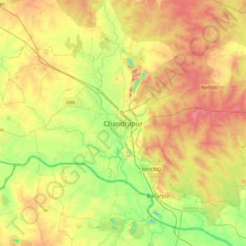
Name: Chandrapur topographic map, elevation, terrain.

Location: Chandrapur, Maharashtra, 442401, India (19.79082 79.13867 20.11082 79.45867)

Average elevation: 200 m

Minimum elevation: 137 m

Maximum elevation: 274 m

Gear up for your next adventure:

🎿Telescopic Trekking Poles - Reduces knee strain on steep topographic descents
🧤Waterproof Overmitts - Extreme weather protection for hikers and mountaineers
👖Convertible Hiking Trousers - Versatile zip-off pants for changing mountain weather conditions
📱Rugged Phone Cases - Heavy-duty protection for smartphones used as secondary GPS tools
👖Hiking Trousers - Durable trousers designed for rough terrain

As an Amazon Associate, this site earns from qualifying purchases at no extra cost to you.