
Make a donation
Gear up for your next adventure:
As an Amazon Associate, this site earns from qualifying purchases at no extra cost to you.
Cenej topographic map
Click on the map to display elevation.
Make a donation
Gear up for your next adventure:
As an Amazon Associate, this site earns from qualifying purchases at no extra cost to you.
About this map
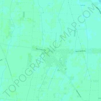
Name: Cenej topographic map, elevation, terrain.
Average elevation: 82 m
Minimum elevation: 78 m
Maximum elevation: 85 m
Make a donation
Gear up for your next adventure:
As an Amazon Associate, this site earns from qualifying purchases at no extra cost to you.
Other topographic maps
Click on a map to view its topography, its elevation and its terrain.
Novi Sad
Serbia > Vojvodina > South Backa Administrative District
The city lies on the meander of the river Danube, which is only 350 meters wide beneath the marking stones of Petrovaradin. A section of the Danube-Tisza-Danube Canal marks the northern edge of the wider city centre. The main part of the city lies on the left bank of the Danube in the region of Bačka, while…
Average elevation: 83 m
Sremski Karlovci Municipality
Serbia > Vojvodina > South Backa Administrative District
Average elevation: 178 m
Novi Sad
Serbia > Vojvodina > South Backa Administrative District
The city lies on the meander of the river Danube, which is only 350 meters wide beneath the marking stones of Petrovaradin. A section of the Danube-Tisza-Danube Canal marks the northern edge of the wider city centre. The main part of the city lies on the left bank of the Danube in the region of Bačka, while…
Average elevation: 83 m
Make a donation
Gear up for your next adventure:
As an Amazon Associate, this site earns from qualifying purchases at no extra cost to you.
Maglic
Serbia > Vojvodina > South Backa Administrative District > Backi Petrovac Municipality
Average elevation: 83 m
Petrovaradin
Serbia > Vojvodina > South Backa Administrative District
Petrovaradin is located in the Syrmia region, on the Danube river and Fruška Gora, a horst mountain with elevation of 78–220 m (municipality up to 451 m). The northern part of Fruška Gora consists of massive landslide zones, but they are not active, except in Ribnjak neighborhood (between Sremska Kamenica…
Average elevation: 105 m
Make a donation
Gear up for your next adventure:
As an Amazon Associate, this site earns from qualifying purchases at no extra cost to you.
Gardinovci
Serbia > Vojvodina > South Backa Administrative District > Titel Municipality
Average elevation: 78 m
Vizic
Serbia > Vojvodina > South Backa Administrative District > Backa Palanka Municipality
Average elevation: 196 m
Backi Jarak
Serbia > Vojvodina > South Backa Administrative District > Temerin Municipality
Average elevation: 82 m
Agla
Serbia > Vojvodina > South Backa Administrative District > Titel Municipality > Gardinovci
Average elevation: 76 m
Make a donation
Gear up for your next adventure:
As an Amazon Associate, this site earns from qualifying purchases at no extra cost to you.
Backi Jarak
Serbia > Vojvodina > South Backa Administrative District > Temerin Municipality
Average elevation: 82 m
Novi Sad
Serbia > Vojvodina > South Backa Administrative District
The city lies on the meander of the river Danube, which is only 350 meters wide beneath the marking stones of Petrovaradin. A section of the Danube-Tisza-Danube Canal marks the northern edge of the wider city centre. The main part of the city lies on the left bank of the Danube in the region of Bačka, while…
Average elevation: 83 m
Beocin
Serbia > Vojvodina > South Backa Administrative District > Beocin Municipality
Average elevation: 226 m
Make a donation
Gear up for your next adventure:
As an Amazon Associate, this site earns from qualifying purchases at no extra cost to you.
Novi Sad
Serbia > Vojvodina > South Backa Administrative District
The city lies on the meander of the river Danube, which is only 350 meters wide beneath the marking stones of Petrovaradin. A section of the Danube-Tisza-Danube Canal marks the northern edge of the wider city centre. The main part of the city lies on the left bank of the Danube in the region of Bačka, while…
Average elevation: 83 m
Bačka Palanka
Serbia > Vojvodina > South Backa Administrative District > Backa Palanka Municipality
Average elevation: 89 m
Žabalj
Serbia > Vojvodina > South Backa Administrative District > Општина Жабаљ
Average elevation: 78 m
Bačka Palanka
Serbia > Vojvodina > South Backa Administrative District > Backa Palanka Municipality
Average elevation: 89 m
Make a donation
Gear up for your next adventure:
As an Amazon Associate, this site earns from qualifying purchases at no extra cost to you.