
Gunung Bieh topographic map
Interactive map
Click on the map to display elevation.
About this map
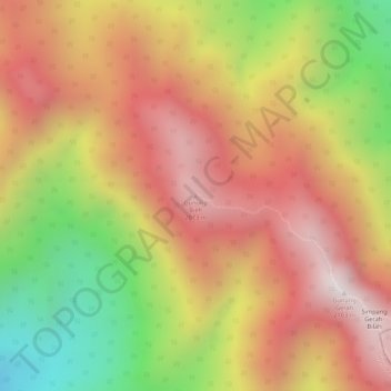
Name: Gunung Bieh topographic map, elevation, terrain.
Location: Gunung Bieh, Hulu Perak District, Perak, Malaysia (5.02343 101.43500 5.02353 101.43510)
Average elevation: 1,741 m
Minimum elevation: 1,256 m
Maximum elevation: 2,066 m
Other topographic maps
Click on a map to view its topography, its elevation and its terrain.
Kampung Baru Simpang Pulai
Malaysia > Perak > Kg. Baru Simpang Pulai > Kampung Baru Simpang Pulai
Average elevation: 54 m