
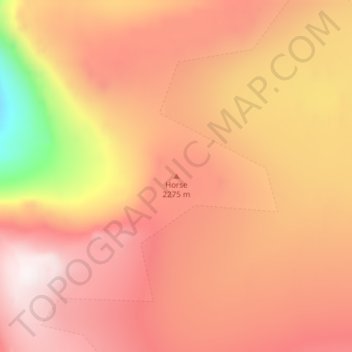
Horse topographic map
Interactive map
Click on the map to display elevation.
About this map
Name: Horse topographic map, elevation, terrain.
Location: Horse, Sermersooq, Greenland (69.09549 -26.80413 69.09559 -26.80403)
Average elevation: 1,842 m
Minimum elevation: 1,293 m
Maximum elevation: 2,133 m
Other topographic maps
Click on a map to view its topography, its elevation and its terrain.
Sisimiut
The shoreline was still at a higher altitude than today, with the Sisimiut valley east of the Kangerluarsunnguaq Bay, partially under sea. Many artifacts and graves from the several centuries of permanent settlement remain scattered in the region. Rich in fauna, the coastal region from Sisimiut to Kangaamiut…
Average elevation: 108 m
Greenland Ice Sheet
The weight of the ice has depressed the central area of Greenland; the bedrock surface is near sea level over most of the interior of Greenland, but mountains occur around the periphery, confining the sheet along its margins. If the ice suddenly disappeared, Greenland would most probably appear as an…
Average elevation: 788 m
Nuuk
Nuuk's sports clubs include Nuuk IL (established in 1934), B-67, and GSS Nuuk. Nuuk Stadium is a multi-purpose stadium, used mostly for football games. The stadium has a capacity of 2,000. The stadium can also be used as an entertainment venue: the Scottish rock band Nazareth performed at the venue. Nuuk also…
Average elevation: 76 m