
Province of Ayabaca topographic map
Interactive map
Click on the map to display elevation.
Province of Ayabaca
The provincial capital is the city of Ayavaca, located at 2,715 meters (8,907 ft) of altitude, with a cold, healthy climate. Its Spanish foundation dates to 1571, when the missionaries gathered the local indigenous population to create the mission village of "Nuestra Señora del Pilar de Ayavaca".
About this map
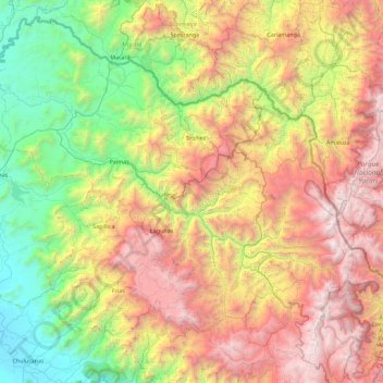
Name: Province of Ayabaca topographic map, elevation, terrain.
Location: Province of Ayabaca, Piura, Peru (-5.11097 -80.29709 -4.28545 -79.39024)
Average elevation: 1,603 m
Minimum elevation: 74 m
Maximum elevation: 3,948 m
Other topographic maps
Click on a map to view its topography, its elevation and its terrain.