Geolocate

Vi topographic map

Interactive map

Click on the map to display elevation.

About this map

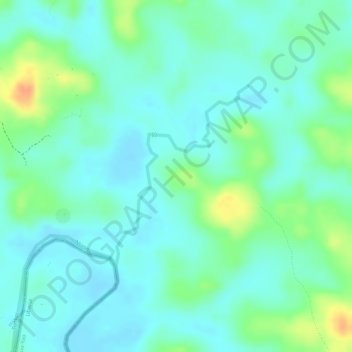
Name: Vi topographic map, elevation, terrain.

Location: Vi, Tonkpi, Montagnes, Côte d'Ivoire (6.86487 -8.30933 6.87869 -8.29912)

Average elevation: 240 m

Minimum elevation: 227 m

Maximum elevation: 268 m

Other topographic maps

Click on a map to view its topography, its elevation and its terrain.

Danané

Côte d'Ivoire > Montagnes

Danané, Tonkpi, Montagnes, Côte d'Ivoire

Average elevation: 351 m

Guiglo

Côte d'Ivoire > Montagnes

Guiglo, Cavally, Montagnes, Côte d'Ivoire

Average elevation: 237 m

Man

Côte d'Ivoire > Montagnes > Man

Man, Tonkpi, Montagnes, 420, Côte d'Ivoire

Average elevation: 451 m

Nimba

Côte d'Ivoire > Montagnes

Nimba, Tonkpi, Montagnes, Côte d'Ivoire

Average elevation: 1,294 m

Biankouma

Côte d'Ivoire > Montagnes

Biankouma, Tonkpi, Montagnes, Côte d'Ivoire

Average elevation: 584 m