Geolocate

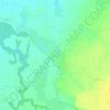
Cenad topographic map

Click on the map to display elevation.

About this map

Name: Cenad topographic map, elevation, terrain.

Location: Cenad, Timiș, Romania (46.07114 20.47288 46.18993 20.62002)

Average elevation: 85 m

Minimum elevation: 80 m

Maximum elevation: 95 m

Other topographic maps

Click on a map to view its topography, its elevation and its terrain.
Cadar

Romania > Timiș

Average elevation: 129 m

Vizejdia

Romania > Timiș

Average elevation: 86 m

Crivobara

Romania > Timiș

Average elevation: 181 m

Bunea Mare

Romania > Timiș > Făget

Average elevation: 206 m

Lugoj

Romania > Timiș

The territory of Lugoj belongs to the high plain of Lugoj and the hills of Lugoj. Located in the contact area of these units, the city developed on the lower terrace of the Timiș River, on both its banks. The relief unit in which Lugoj is located is the Lugoj Plain, which penetrates deep into the piedmont…

Average elevation: 166 m

Banat

Romania > Timiș > Recaș

Average elevation: 296 m

Honorici

Romania > Timiș

Average elevation: 164 m

Gladna Montană

Romania > Timiș

Average elevation: 299 m

Botanic Park

Romania > Timiș > Timișoara

Average elevation: 93 m

Bodo

Romania > Timiș

Average elevation: 131 m

Colonia Fabricii

Romania > Timiș

Average elevation: 405 m

Groși

Romania > Timiș

Average elevation: 259 m

Sălciua Nouă

Romania > Timiș

Average elevation: 191 m

Remetea Mică

Romania > Timiș

Average elevation: 156 m

Drinova

Romania > Timiș

Average elevation: 239 m

Blajova

Romania > Timiș

Average elevation: 111 m

Gear up for your next adventure:

🔋Power Banks - Portable chargers for long outdoor trips
🧰Survival Kits - Emergency tools for remote environments
🔦Outdoor Torches - Reliable torches for night navigation
👕Technical Hiking Tees - Moisture-management for high-exertion climbs
💧Hydration Reservoirs - Convenient water bladders for hands-free drinking on the move

As an Amazon Associate, this site earns from qualifying purchases at no extra cost to you.