Geolocate

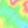
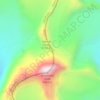
Tata topographic map

Click on the map to display elevation.

About this map

Name: Tata topographic map, elevation, terrain.

Location: Tata, Bhatwari, Uttarkashi, Uttarakhand, India (30.90476 78.62755 30.90486 78.62765)

Average elevation: 3,585 m

Minimum elevation: 2,916 m

Maximum elevation: 4,130 m

Other topographic maps

Click on a map to view its topography, its elevation and its terrain.
Harsil

India > Uttarakhand > Bhatwari

Average elevation: 2,761 m

Kyarkoti Lake

India > Uttarakhand > Bhatwari

Average elevation: 4,043 m

Pari Maatri Taal

India > Uttarakhand > Bhatwari

Average elevation: 4,443 m

Kedar Tal

India > Uttarakhand > Bhatwari

Average elevation: 4,814 m

Pulam Sumda

India > Uttarakhand > Bhatwari

Average elevation: 4,571 m

Gangotri Glacier

India > Uttarakhand > Bhatwari

Average elevation: 5,259 m

Dayara Bugyal

India > Uttarakhand > Bhatwari

Average elevation: 3,451 m

Gangotri Glacier

India > Uttarakhand > Bhatwari

Average elevation: 5,259 m

Kedar Tal

India > Uttarakhand > Bhatwari

Average elevation: 4,814 m

Kalindi Khal Area

India > Uttarakhand > Bhatwari

Average elevation: 5,857 m

Harsil

India > Uttarakhand > Bhatwari

Average elevation: 2,761 m

Gear up for your next adventure:

🥤Hiking Water Bottles - Reusable bottles for hydration on the trail
🔥Emergency Fire Starters - Reliable ignition tools for survival situations in damp conditions
📚UK Hiking Guidebooks - Detailed route descriptions for the Lake District, Peaks, and Highlands
📍Handheld GPS Navigators - Reliable satellite navigation for hiking and off-road exploration
🧥Packable Down Jackets - Lightweight warmth that compresses small in your bag

As an Amazon Associate, this site earns from qualifying purchases at no extra cost to you.