
Barós topographic map
Interactive map
Click on the map to display elevation.
About this map
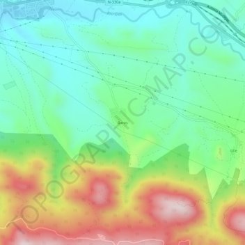
Name: Barós topographic map, elevation, terrain.
Location: Barós, Jaca, Jacétanie, Huesca, Aragon, 22712, Espagne (42.52641 -0.54714 42.56641 -0.50714)
Average elevation: 939 m
Minimum elevation: 779 m
Maximum elevation: 1,230 m
Other topographic maps
Click on a map to view its topography, its elevation and its terrain.
Puerto Astún
Espagne > Aragon > Jacétanie > Jaca
Puerto Astún, Jaca, Jacétanie, Huesca, Aragon, 22889, Espagne
Average elevation: 1,947 m