
Mortier topographic map
Interactive map
Click on the map to display elevation.
About this map
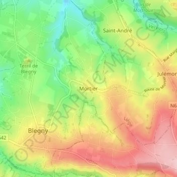
Name: Mortier topographic map, elevation, terrain.
Location: Mortier, Blegny, Liège, Wallonie, 4670, Belgique (50.66218 5.72327 50.70218 5.76327)
Average elevation: 194 m
Minimum elevation: 109 m
Maximum elevation: 290 m
Other topographic maps
Click on a map to view its topography, its elevation and its terrain.
Les Aunois
Belgique > Liège > Liège > Blegny > Les Aunois
Les Aunois, Blegny, Liège, Wallonie, 4670, Belgique
Average elevation: 185 m