Geolocate

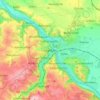
Meissen topographic map

Click on the map to display elevation.

About this map
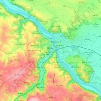
Name: Meissen topographic map, elevation, terrain.

Location: Meissen, Saxony, Germany (51.12927 13.42424 51.19310 13.54170)

Average elevation: 163 m

Minimum elevation: 85 m

Maximum elevation: 264 m

Other topographic maps

Click on a map to view its topography, its elevation and its terrain.

Neurobschütz

Germany > Saxony > Meißen > Robschütz

Average elevation: 205 m

Meissen

Germany > Saxony > Meißen

Average elevation: 162 m

Nossen

Germany > Saxony > Meißen > Nossen

Average elevation: 273 m

Niederstößwitz

Germany > Saxony > Meißen > Käbschütztal

Average elevation: 191 m

Mauna

Germany > Saxony > Meißen > Käbschütztal > Krögis

Average elevation: 205 m

Brettmühlenteich

Germany > Saxony > Meißen > Tauscha

Average elevation: 155 m

Constappel

Germany > Saxony > Meißen

Average elevation: 158 m

Kleinprausitz

Germany > Saxony > Meißen > Käbschütztal

Average elevation: 203 m

Gear up for your next adventure:

🧭GPS Trackers - Tracking devices for safety and navigation
📦Dry Bags - Waterproof bags to protect gear from rain
🪢Paracord - Multi-purpose cord for camping and survival
🧥Waterproof Hiking Jackets - Rain protection for walking in all weather conditions
🚶Walking Pedometers - Simple distance tracking for casual trail walkers

As an Amazon Associate, this site earns from qualifying purchases at no extra cost to you.