Geolocate

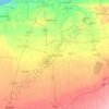
Azzahra topographic map

Click on the map to display elevation.

About this map

Name: Azzahra topographic map, elevation, terrain.

Location: Azzahra, Jafara, Libya (32.65110 12.81118 32.70626 12.92221)

Average elevation: 74 m

Minimum elevation: 38 m

Maximum elevation: 92 m

Other topographic maps

Click on a map to view its topography, its elevation and its terrain.
Assarraj

Libya > Jafara

Average elevation: 25 m

Qasr Bin Ghashir

Libya > Jafara

Average elevation: 76 m

Janzur

Libya > Jafara

On March 6, 1912, the Italian forces became the first to use airships in war, as two dirigibles dropped bombs on Turkish troops and Libyan Mujahideen encamped at Janzour, from an altitude of 6,000 feet.

Average elevation: 20 m

Al Aziziya

Libya > Jafara

Average elevation: 118 m

Al Aziziya

Libya > Jafara

Average elevation: 118 m

Assarraj

Libya > Jafara

Average elevation: 25 m

Gear up for your next adventure:

🎒Hiking Daypacks - Compact backpacks ideal for short hikes and excursions
🥾Hiking Boot Waterproofing Wax - Maintain the lifespan of your leather trekking boots
🧰Survival Kits - Emergency tools for remote environments
🧼Technical Clothing Wash - Special soap to clean and restore waterproof membranes
🦟Anti-Midge & Tick Repellent - Vital for hiking in the Scottish Highlands during summer

As an Amazon Associate, this site earns from qualifying purchases at no extra cost to you.