
Chott Melghir topographic map
Interactive map
Click on the map to display elevation.
About this map
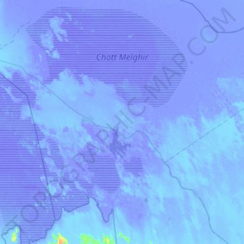
Name: Chott Melghir topographic map, elevation, terrain.
Location: Chott Melghir, El M'Ghair, Algeria (33.85978 5.93099 34.33387 6.46288)
Average elevation: -23 m
Minimum elevation: -33 m
Maximum elevation: 19 m
Other topographic maps
Click on a map to view its topography, its elevation and its terrain.
El M'Ghair
Algeria > El M'Ghair > El M'Ghair District > El M'Ghair
El M'Ghair, El M'Ghair District, El M'Ghair, Algeria
Average elevation: 48 m
Djamaa
Algeria > El M'Ghair > Djamaa District
Djamaa, Djamaa District, El M'Ghair, Algeria
Average elevation: 57 m