
Arnhem Land topographic map
Interactive map
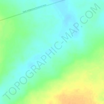
Click on the map to display elevation.
About this map
Name: Arnhem Land topographic map, elevation, terrain.
Average elevation: 65 m
Minimum elevation: 51 m
Maximum elevation: 84 m
Other topographic maps
Click on a map to view its topography, its elevation and its terrain.
Tasmania
The most mountainous region is the Central Highlands area, which covers most of the central western parts of the state. The Midlands located in the central east, is fairly flat, and is predominantly used for agriculture, although farming activity is scattered throughout the state. Tasmania's tallest mountain…
Average elevation: 220 m
Mount Coot-tha
It is often claimed that Mount Coot-tha is the "highest point in Brisbane", but, as the elevations above show, the peak known as Mount Coot-tha is not even the highest peak of the mountain as a whole with both Constitution Hill and The Summit being higher. However, Mount Coot-tha has a lookout with unobscured…
Average elevation: 88 m
Lapstone
Australia > New South Wales > Sydney
Lapstone is an Australian township on the eastern escarpment of the Blue Mountains in New South Wales at an elevation of 160 m (525 ft). Lapstone is located 62 kilometres west of the Sydney CBD in the local government area of the City of Blue Mountains and is part of the federal electorate of Macquarie.…
Average elevation: 109 m
Gawler
Gawler is the oldest country town on the Australian mainland in the state of South Australia. It was named after the second Governor (British Vice-Regal representative) of the colony of South Australia, George Gawler. It is about 40–44 km (25–27 mi) north of the state capital, Adelaide, and is close to the…
Average elevation: 63 m
Second Valley
Australia > South Australia > The District Council of Yankalilla
Average elevation: 173 m