
Simandhar Tenements & Flats topographic map
Interactive map
Click on the map to display elevation.
About this map
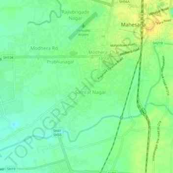
Name: Simandhar Tenements & Flats topographic map, elevation, terrain.
Average elevation: 87 m
Minimum elevation: 75 m
Maximum elevation: 100 m
Other topographic maps
Click on a map to view its topography, its elevation and its terrain.
Mahesana
India > Gujarat > Mahesana Taluka
Mahesana, Mahesana Taluka, Mahesana District, Gujarat, 384001, India
Average elevation: 92 m