
Eikerapen topographic map
Interactive map
Click on the map to display elevation.
About this map
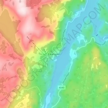
Name: Eikerapen topographic map, elevation, terrain.
Location: Eikerapen, Åseral, Agder, Norway (58.51996 7.33998 58.55996 7.37998)
Average elevation: 432 m
Minimum elevation: 252 m
Maximum elevation: 697 m
Other topographic maps
Click on a map to view its topography, its elevation and its terrain.