Geolocate

Aarughat topographic map

Interactive map

Click on the map to display elevation.

About this map

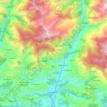
Name: Aarughat topographic map, elevation, terrain.

Location: Aarughat, Gorkha, Gandaki Pradesh, Nepal (28.03958 84.74159 28.19929 84.97064)

Average elevation: 1,473 m

Minimum elevation: 460 m

Maximum elevation: 3,282 m

Other topographic maps

Click on a map to view its topography, its elevation and its terrain.

Deurali

Nepal > Gorkha

Deurali, Gorkha, Gandaki Pradesh, Nepal

Average elevation: 574 m

Gumda

Nepal > Gorkha > Gumda

Gumda, Dharche, Gorkha, Gandaki Pradesh, Nepal

Average elevation: 2,392 m

Manakamana

Nepal > Gorkha > Manakamana

Manakamana, Sahid Lakhan, Gorkha, Gandaki Pradesh, Nepal

Average elevation: 1,014 m

Manaslu

Nepal > Gorkha > Samagau

Manaslu, Samagau, Chum Nubri, Gorkha, Gandaki Pradesh, Nepal

Average elevation: 7,069 m