
Town of Bristol topographic map
Interactive map
Click on the map to display elevation.
About this map
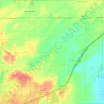
Name: Town of Bristol topographic map, elevation, terrain.
Location: Town of Bristol, Dane County, Wisconsin, United States (43.19513 -89.24575 43.28280 -89.12674)
Average elevation: 287 m
Minimum elevation: 260 m
Maximum elevation: 320 m
Other topographic maps
Click on a map to view its topography, its elevation and its terrain.
Isthmus Path Prairie Garden
United States > Wisconsin > Dane County > Madison
Average elevation: 262 m