Geolocate

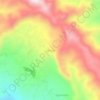
Talaga topographic map

Click on the map to display elevation.

About this map

Name: Talaga topographic map, elevation, terrain.

Location: Talaga, Pasirwangi, Garut, West Java, Java, Indonesia (-7.23171 107.76897 -7.21297 107.80038)

Average elevation: 1,213 m

Minimum elevation: 1,058 m

Maximum elevation: 1,432 m

Other topographic maps

Click on a map to view its topography, its elevation and its terrain.
Cisurupan

Indonesia > West Java > Garut

Average elevation: 1,243 m

Cihurip

Indonesia > West Java > Garut

Average elevation: 910 m

Sirnajaya

Indonesia > West Java > Garut

Average elevation: 1,343 m

Cikajang

Indonesia > West Java > Garut

Average elevation: 1,271 m

Rancabango

Indonesia > West Java > Garut

Average elevation: 840 m

Gunung Cakra

Indonesia > West Java > Garut

Average elevation: 1,771 m

Cikuray

Indonesia > West Java > Garut > Barusuda

Average elevation: 1,289 m

LAPANGBOLA MANGUNJAYA

Indonesia > West Java > Garut > Kadongdong

Average elevation: 778 m

Cikedokan

Indonesia > West Java > Garut

Average elevation: 929 m

Sucikaler

Indonesia > West Java > Garut

Average elevation: 729 m

Karya Mekar

Indonesia > West Java > Garut

Average elevation: 1,633 m

Sukahati

Indonesia > West Java > Garut

Average elevation: 1,150 m

Pakuwon

Indonesia > West Java > Garut

Average elevation: 1,122 m

Gunung Putri

Indonesia > West Java > Garut

Average elevation: 1,398 m

Gear up for your next adventure:

🛌Insulated Sleeping Mats - Crucial thermal protection when sleeping on cold, uneven ground
🧣Fleece Neck Warmers - Extra insulation for winter topographic surveys
🧼Technical Clothing Wash - Special soap to clean and restore waterproof membranes
🧢Waterproof Hiking Hats - Keep the rain off your face while studying topographic maps
👟Men's Trail Running Shoes - Lightweight grip for fast movement over topographic contours

As an Amazon Associate, this site earns from qualifying purchases at no extra cost to you.