
Thank you for supporting this site ❤️
Make a donation
Make a donation
Gear up for your next adventure:
As an Amazon Associate, this site earns from qualifying purchases at no extra cost to you.
Hathnur topographic map
Click on the map to display elevation.
Thank you for supporting this site ❤️
Make a donation
Make a donation
Gear up for your next adventure:
As an Amazon Associate, this site earns from qualifying purchases at no extra cost to you.
About this map
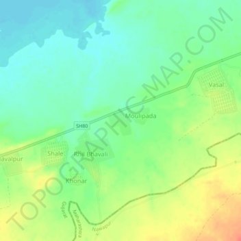
Name: Hathnur topographic map, elevation, terrain.
Location: Hathnur, Nizar Taluka, Tapi District, Gujarat, India (21.40565 73.96605 21.44565 74.00605)
Average elevation: 116 m
Minimum elevation: 96 m
Maximum elevation: 145 m
Thank you for supporting this site ❤️
Make a donation
Make a donation
Gear up for your next adventure:
As an Amazon Associate, this site earns from qualifying purchases at no extra cost to you.