
Bayzaq District topographic map
Interactive map
Click on the map to display elevation.
About this map
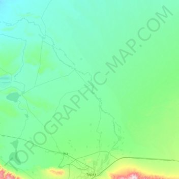
Name: Bayzaq District topographic map, elevation, terrain.
Location: Bayzaq District, Jambyl Region, 800899, Kazakhstan (42.86964 71.10574 44.02263 72.26184)
Average elevation: 473 m
Minimum elevation: 335 m
Maximum elevation: 1,934 m
Other topographic maps
Click on a map to view its topography, its elevation and its terrain.
Саудакент
Kazakhstan > Jambyl Region > Sarysu District
Саудакент, Sarysu District, Jambyl Region, Kazakhstan
Average elevation: 339 m
Taraz
Kazakhstan > Jambyl Region > Taraz
Taraz, Тараз Г.А., Jambyl Region, 080000, Kazakhstan
Average elevation: 631 m
Lake Balkhash
Lake Balkhash, Moiynkum District, Jambyl Region, Kazakhstan
Average elevation: 394 m