
Wazuka topographic map
Interactive map
Click on the map to display elevation.
About this map
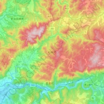
Name: Wazuka topographic map, elevation, terrain.
Location: Wazuka, Soraku County, Kyoto Prefecture, Japan (34.76323 135.86038 34.85501 136.02846)
Average elevation: 311 m
Minimum elevation: 33 m
Maximum elevation: 669 m
Other topographic maps
Click on a map to view its topography, its elevation and its terrain.