
Talang Ulu topographic map
Interactive map
Click on the map to display elevation.
About this map
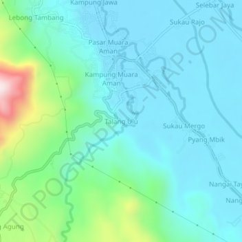
Name: Talang Ulu topographic map, elevation, terrain.
Location: Talang Ulu, Lebong Utara, Bengkulu, Indonesia (-3.15014 102.18126 -3.11014 102.22126)
Average elevation: 433 m
Minimum elevation: 328 m
Maximum elevation: 874 m
Other topographic maps
Click on a map to view its topography, its elevation and its terrain.