
Make a donation
Gear up for your next adventure:
As an Amazon Associate, this site earns from qualifying purchases at no extra cost to you.
Pentre Halkyn topographic map
Click on the map to display elevation.
Make a donation
Gear up for your next adventure:
As an Amazon Associate, this site earns from qualifying purchases at no extra cost to you.
About this map
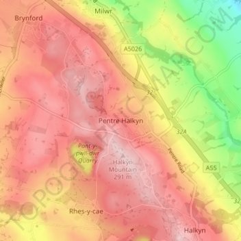
Name: Pentre Halkyn topographic map, elevation, terrain.
Location: Pentre Halkyn, Flintshire, Wales, CH8 8JA, United Kingdom (53.22395 -3.22706 53.26395 -3.18706)
Average elevation: 207 m
Minimum elevation: 57 m
Maximum elevation: 292 m
Flintshire trails, hiking, mountain biking, running and outdoor activities
Make a donation
Gear up for your next adventure:
As an Amazon Associate, this site earns from qualifying purchases at no extra cost to you.
Other topographic maps
Click on a map to view its topography, its elevation and its terrain.
Make a donation
Gear up for your next adventure:
As an Amazon Associate, this site earns from qualifying purchases at no extra cost to you.