
Mono Island topographic map
Interactive map
Click on the map to display elevation.
About this map
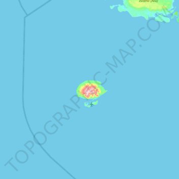
Name: Mono Island topographic map, elevation, terrain.
Location: Mono Island, Western, Solomon Islands (-7.68249 155.24033 -7.04249 155.88033)
Average elevation: 3 m
Minimum elevation: 0 m
Maximum elevation: 329 m
Other topographic maps
Click on a map to view its topography, its elevation and its terrain.