
Gizo topographic map
Interactive map
Click on the map to display elevation.
About this map
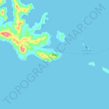
Name: Gizo topographic map, elevation, terrain.
Location: Gizo, Western, Solomon Islands (-8.14547 156.80136 -8.06547 156.88136)
Average elevation: 6 m
Minimum elevation: -1 m
Maximum elevation: 113 m
Other topographic maps
Click on a map to view its topography, its elevation and its terrain.
Tetepare Island
Tetepare Island, Western, Solomon Islands
Average elevation: 28 m
Shortland Island
Shortland Island, Western, Solomon Islands
Average elevation: 21 m