
Hördt topographic map
Interactive map
Click on the map to display elevation.
Hördt
Zur Römerzeit befand sich auf einer Anhöhe nach Bellheim hin ein römischer Wartturm (specula), an dem sich zwei römische Verkehrswege kreuzten (heutige Gewanne „Alter Turm“). Weitere Funde z. B. Göttersteine und ein Brückenstein aus dem 2. Jahrhundert lassen eine römische Siedlung mit weiteren Gebäuden vermuten.
About this map
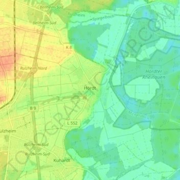
Name: Hördt topographic map, elevation, terrain.
Average elevation: 107 m
Minimum elevation: 92 m
Maximum elevation: 127 m
Other topographic maps
Click on a map to view its topography, its elevation and its terrain.
Schaidt
Deutschland > Rheinland-Pfalz > Landkreis Germersheim > Wörth am Rhein
Average elevation: 146 m
Maximiliansau
Deutschland > Rheinland-Pfalz > Landkreis Germersheim > Wörth am Rhein
Average elevation: 106 m